Anyways...the hike. When we got back people asked if we enjoyed the hike, or if we had a good time--I find this a difficult question to answer. Was the scenery beautiful? Yes. Was it awesome to camp by the ocean? Yes. Did we run into any aggressive wild life like bears or cougars? No. Did we have to climb enormous hills, just to go back down them and repeat 4-5 times in one day? Yes. Did we slog through mud (ankle deep at times)? Yes. Did I enjoy all aspects of this? No, not exactly, but would I do it again? Yes, without a doubt. I want to do the 75-km West Coast Trail next year, where Parks Canada requires you to take an 1.5 hour orientation session before you can enter the trail. So why, if I can't say I exactly enjoyed myself would I want to do something like this again? Because, as I repeated to myself several times while hiking up and down those hills: I choose to do this not because it is easy, but because it is hard (yes, that's what JFK said about getting to the moon). Also, it appeals to my sense of adventure.
We spent the morning of the 24th running around picking up things we still needed, such as a stove (which we had to leave at the Edmonton Airport--see lesson learned No. 1), pants and gaiters for Andrew, bear spray, etc. Then we also decided to pick up new poi (again, see lesson No. 1), which meant we didn't get to the China Beach parking lot until almost 2:00 pm. Thankfully, the beginning part of the trail isn't too challenging, so we were able to reach our first campsite by around 5:30 pm. We set up our tent, pulled out our food and settled in for the night. There's tons of drift wood on the beaches, which make for reasonably comfy chairs--a good thing, since there weren't any actual picnic tables (which there were on the Jasper Skyline). We had to eat off our knees, but we didn't mind since dinner was delicious (quinoa salad, with dried fruit and bacon). We tried to get a campfire going as well, but the wood was too damp and even dousing it with a little kerosene didn't result in a steady blaze.
 |
| Me, right at the beginning of the trail, the first suspension bridge we approached. |
 |
| Also near the beginning of the trail, one of the first log-steps/ladders that we encountered. |
 |
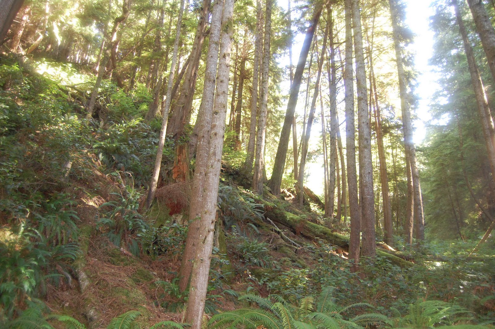
| An example of some of the beautiful scenery we viewed on the first day of our hike. |
 |
| Seagulls hanging out at Chin Beach, the first site we stayed at, approximately 9 km into the hike. |
At Bear Beach (21 km into the trail) we soaked our feet in the icy water of the Pacific--it felt great despite the cold. We set up at an awesome site where the tent was enclosed with tree which was connected by a short path to a sort of 'living room' set up with large pieces of driftwood centred around a fire pit. We sat on the logs for almost an hour just watching the waves before we made dinner. This night we were easily able to get a fire going, a relief since it was colder than our first. It also got very misty and from our spot we couldn't quite tell if it was raining or just really foggy as we were sitting under tree cover. We ended up going to bed early. It was wet-ish, and cool, and we decided we were going to try for a longer hike on our third day and would therefore need to get up earlier.
 |
| The morning of our second day, before we'd managed to get packed up on Chin Beach. |
 |
| An example of the scenery on the second day. There were lots of ups and downs this day. |
 |
| The ocean at our second stop, Bear Beach, 21 km into the trail. |
I was exhausted by the time we reach Payzant. The last 3 km (we had a break at 37 km, unfortunately the spot was only a parking lot, not a campsite) were a blurr and it was pretty much just determination that kept me going. It took us 8 hours to cover 19 km, reaching our destination around 6:00 pm. The mud probably slowed us down a bit (pausing to look for ways around, instead of through it) and it left my feet really damp and unpleasant by the time we reached our site. I basically had the start of 'trench foot' developing and would have been in serious trouble if I hadn't been able to let my skin air-dry. Fortunately it was fairly warm at the forest campsite, so I was able to sit and make dinner without wearing socks, which helped immensely. My feet were more-or-less okay (aside from a bit of blistering on my heels) the next morning.
 |
| Sun shining through the trees on the morning of our third day. |
 |
| One of the log bridges we crossed. This one had no hand rail, and hadn't been evened out on top. |
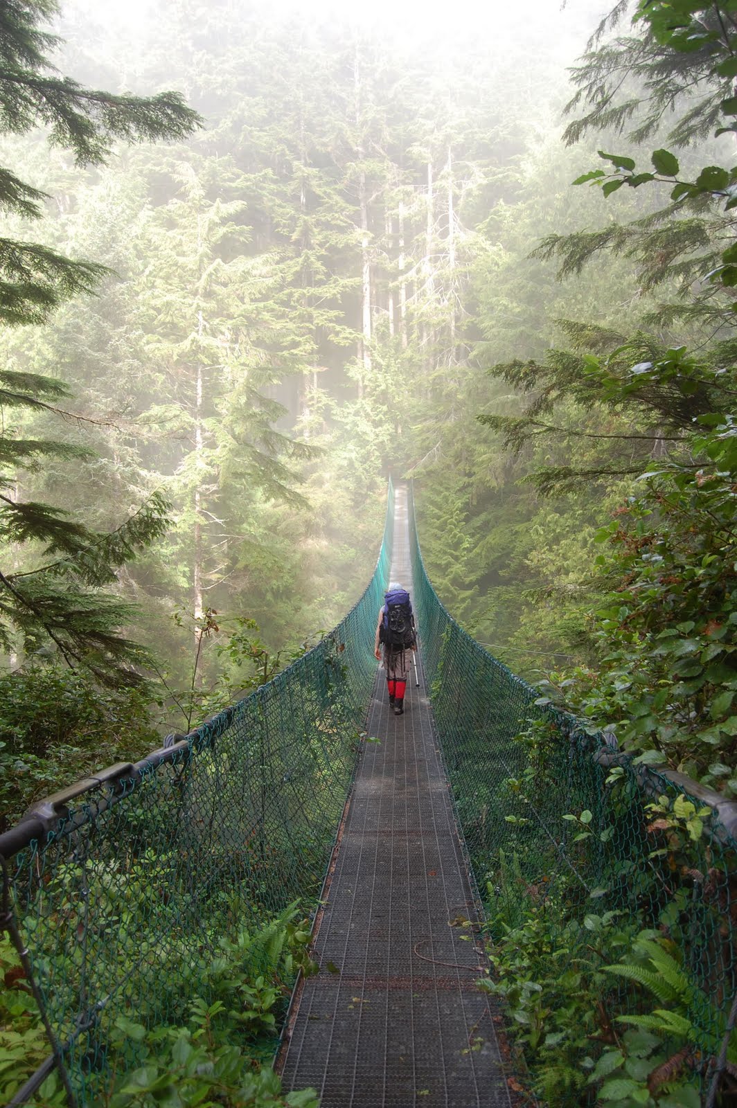 |
| The really big suspension bridge we crossed leading up to Sombrio Beach on our third day. |
 |
| Another example of the great scenery to be had along the trail. |
 |
| The Payzant Creek, the location of our third and final campsite 40 km into the hike. |
The final 2.5 km was a breeze--along a paved road with only a couple of gentle hills. We probably could have attempted to hitchhike, but I figured we could manage the last bit on our own. It only took us 40 minutes to reach the town (village?), so we probably could have stuck to our original plans after all. We took advantage of our extra time before the shuttle arrived to relax at the Port Renfrew Hotel Pub. It was the prefect treat after 4 days of eating off our knees out of doors. The beer was good and cold, while the food was hot and tasty. We demolished a giant plate of nachos, then we each had a entree as well. We had plenty of time to hit the washroom, pay, and get to the shuttle pick up on time.
 |
| The scenery at Tom Baird Creek, just a km or two away from Botanical Beach. We sat and had a quick rejuvenating break before finishing off the trail. |
 |
| Me and Andrew at Botanical Beach. We sat for an hour, had lunch, stuck our feet in the Ocean, relaxed before finishing the last km of the trail. |
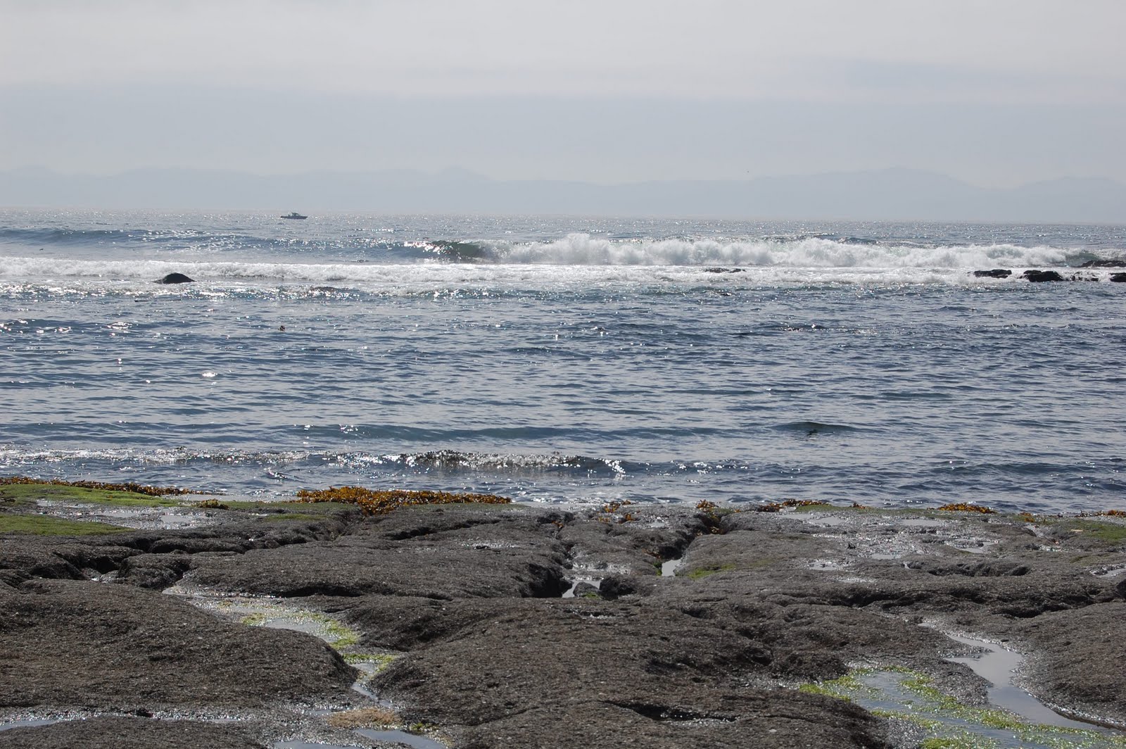 |
| The ocean at Botanical Beach. |
 |
| The pub at Port Renfew. Delicious! |
1) There are covered outhouses at all of the campsites, which include toilet paper.
2) There are also food cashes (heavy metal boxes with giant clips to keep them closed) at every campsite, usually near the outhouse.
3) There are creeks near every campsite, so there's a source of water (once filtered) for drinking/cooking.
4) It was extremely muddy when we were there, so gaiters are a good idea.
Lessons learned:
1) Airlines do not permit camp stoves even as checked luggage, even if you're not packing fuel. We had to purchase a new stove at the MEC in Victoria.
2) 19 km really is too much to hike in one day (for us at least) while carrying packs and going over hilly, muddy terrain. We ran into this problem last year as well, but the lesson clearly didn't stick.
3) Camel packs are way better for hydration than water bottles. You don't have to stop and unscrew a lid to drink, encouraging more water intake; however, when you're sweating rivers, it's hard to keep properly hydrated no matter what.
4) I really shouldn't feel bad about carrying less than Andrew. At least one of the figures I've seen suggests that women should only be carrying about a quarter of their body weight, and men a third. Andrew weights more than me, and is a man, therefore he should carry more.
Ciao,
Andrea
1 comment:
I always get jealous when I see your beautiful hiking photos but then I read about the inclines/mud and I appreciate that I'd never be able to hack it, so I just enjoy the photos. Lovely photos by the way!
Post a Comment